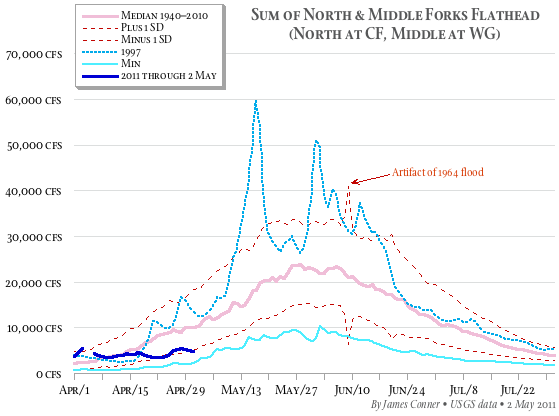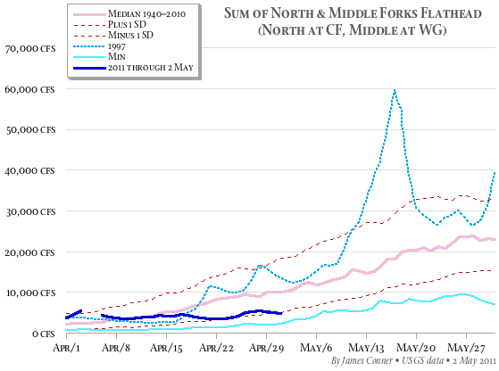
The Flathead’s snowpack is high, but the flow in unregulated streams is low. That, say the National Weather Service’s forecasters, suggests a late runoff and high water, especially if warm weather is compounded by gullywashers in the mountains.
One way of making sense of the situation is comparing the combined flows of the Flathead River’s north and middle forks to the historical record. Both forks are wild, so their behavior is a good indicator of current conditions and has some predictive value.
The hydrographs below display the norms for the sum of the north and middle forks for water years (October through September) 1940 through 2010, and the values for 1997, a heavy snow year to which 2011 reportedly is comparable, and 2011 through 2 May.
If you live in the floodplain, you’ll want to keep your chest waders handy.